Maps 101 : GIS for Beginners and Proto’s GIS Training Wiki
This is part #4 of an ongoing series where we delve into the technical aspects of cartography, real-world case studies of its utility and insights into the industry. Subscribe and Join us for the ride! At the end, you’ll be as enthusiastic about maps as we are. Check out the rest of Maps 101
If you’ve popped your head into mapping twitter or just googled mapping; you’ve probably heard the acronym GIS, or maybe sometimes QGIS or ArcGIS.

GIS, or Geographic Information Systems, are a set of technologies, hardware and software that help us manage, share, analyze, and present spatial and geographic data. The term itself was first coined by Roger Tomlinson in the mid-1960s, the concepts and methods however date back several decades. One of the first notable examples of the practical use of these concepts is John Snow’s spatial analysis to trace the cholera outbreak in London, setting a precedent for the use of geographical information in solving real-world problems.
Over the years, GIS has grown from a specialized tool for scientists and researchers to an indispensable asset across various fields, integrating cartography, statistical analysis, and data visualization in unique ways. GIS today is an umbrella term that covers a broad tech-stack involved in geospatial work. However, there are general purpose tools that have over time become foundational in GIS, the most prominent being QGIS & ArcGIS.

And whats it for ?
The adoption of GIS technology transcends numerous sectors, reflecting its versatile applicability. Whether it’s in urban planning, where city officials plot out future developments, or in environmental management, where researchers track deforestation and climate change impacts, GIS tools offer a unique lens to view and interact with our world.

In public health, GIS is instrumental in disease pattern analysis, a modern echo of John Snow’s cholera study. In agriculture, it aids in precision farming, optimizing land use and crop yields. Even in sectors like business and marketing, GIS data drives decisions about where to open new stores or how to target advertisements based on geographical data.
So, how do you get started ?
For those new to GIS, starting with user-friendly, open-source tools like QGIS is an excellent choice. It offers robust capabilities without the steep price tag of some commercial options. And while learning stuff step by step is a good option (there are a lot of channels & videos out there, to get it going); we recommend getting down and dirty as the first step.
Here’s how,
The GIS Training Wiki
We’ve started putting together a “GIS Training Wiki” with a list of beginner friendly projects. Anything on this list, can be done using the resources provided and the QGIS docs. And we went ahead and built a GIS-GPT sidekick to support you in this process as well.

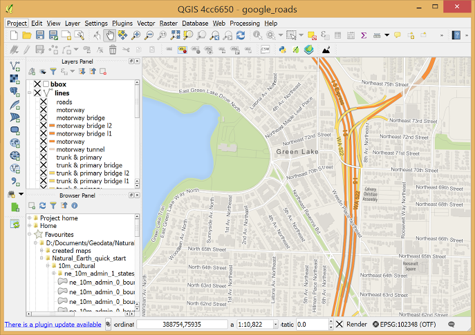
As a liftoff point, here’s an example from the list. The first project or “challenge” is QGIS Setup & Basics. All you have to do is to Install QGIS, load up a base map and run through a few basic functions. You can pop open our companion GPT and start by asking to explain challenge step by step. And you’re off to the races.

The wiki is open source and freely editable. So as you progress through this journey we request you to keep contributing newer challenges that you think will help others in their learning process. We’re also adding things to the wiki constantly to make it more valuable to everyone. To that end, please share ideas, resources and things you might want to see on the tool.
And if the wiki and GPT are too tedious or if you feel the need for collaborative work, we’ll be hosting GIS Office Hours starting January to help you out even better over a call. All calls will be hosted in our Gather Workspace, where you can pop-in, work on your stuff and collaborate with both your peers and GIS experts who will assist you.
Wrapping up,
It’s often daunting to get into new stuff, and especially Geo-data & GIS, cause it looks really complicated from the outside. Well its not. Treat this like learning how to swim, wade in first and get going. From there, you can easily teach yourself whatever you want with a little bit of help from our tools and your friends.
It is still true however that there is no significant middle-ground in the geospatial industry. Something that combines the feature richness of QGIS with the ease of use of the proto app. And thats the gap we’ll seek to fill out very soon with a browser based extension to our app. With our focus on empowering mappers as content creators, we want to build something that helps both the pro-mappers and the newbies to create freely and monetize effectively. So keep your eyes peeled for an announcement there and follow us to stay abreast of all thats going on behind the scenes.
Join us on this mission,
You can follow us on twitter & instagram, and if you wanna get started on proto; join our online onboarding events
We also hang out on group chat here, feel free to drop by!
See you soon and Happy Mapping !
